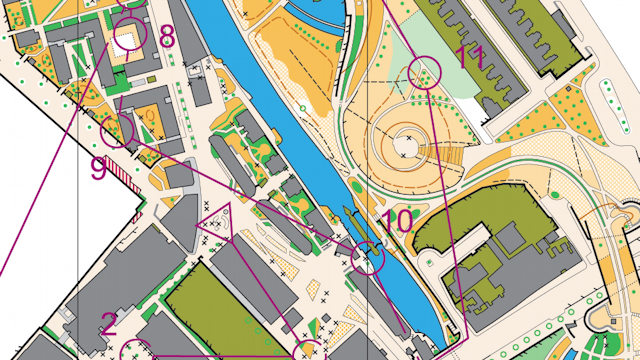
This orienteering map was produced in Adobe Illustrator for a special sprint race at the Queen Mary (University of London) campus in East London, including part of Mile End Park. The printed map was at 1:4000 and was produced to the ISSOM (International Specification for Sprint Orienteering Mapping) standard. Because of the larger scale, more detail is shown, such as crosses representing benches.
Printed. Based on Ordnance Survey mapping with the permission of Her Majesty’s Stationery Office. Crown Copyright. License No. 42323U. BOF Registration SE-08-624.