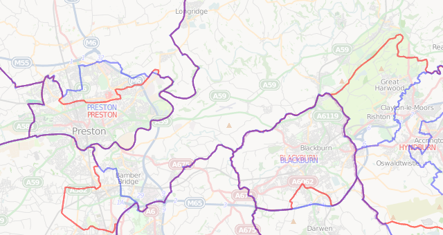
Showing the spatial impact of the proposed Boundary Commission revised constituency boundary changes (released in late 2016, for possible implementation in 2018) for the UK home nations (England, Scotland, Wales and Northern Ireland), by means of a slider fading between the current (red) and proposed (blue) outlines.
The website uses browser geolocation to default to your local area, and an OpenStreetMap background map. It is simple (200 lines of HTML/Javascript + Stylefiles for the Mapnik-based boundary map images), written in HTML5, and mobile-friendly. The original version (showing the 2013 proposals) was assembled in less than a couple of hours following publication of the data by the Boundary Commission for England. The latest version incorporates the proposals from the commissions of all four of the home nations, together in a seamless map. Zoom in to see the current/proposed names. The 2013 version also remains available for historical interest.